expedia

7 day Osh Yukhin Peak Tour

By Alay Travel Guide
Free cancellation available
Price is NZ$1,498 per adult
Features
  • Free cancellation available
  • 7d
  • Mobile voucher
  • Instant confirmation
  • Multiple languages
Overview

If you're seeking a distinctive trekking experience in the Alay region, we recommend our comprehensive tour that encompasses the area's most renowned attractions. The journey commences in Osh and, upon completion, offers several options for further exploration. As local tour operators, we possess in-depth knowledge of effective acclimatisation strategies. Therefore, this tour is designed to gradually ascend from lower altitudes (1,000 metres) to higher elevations, culminating at the scenic viewpoint of Yukhin Peak (5,130 metres).
This 7day trek is a majestic adventure, offering breathtaking mountain landscapes and close-up views of Lenin Peak—the second-highest peak in Central Asia. Thousands of climbers and trekkers visit the region during the summer season.

Activity location

  • Car park "Kojo-Kelen"
    • Kyzyl-Tala, Osh Region, Kyrgyzstan

Meeting/Redemption Point

  • Osh City
    • Osh City, Osh City, Kyrgyzstan

Check availability


7 day Osh Yukhin Peak Tour
  • Activity duration is 7 days7d
    7d
  • English

Pickup included

Starting time: 8:00 am
Price details
NZ$1,497.87 x 1 AdultNZ$1,497.87

Total
Price is NZ$1,497.87

What's included, what's not

  • What's includedWhat's includedPrivate transport
  • What's includedWhat's includedEnglish or Russian speaking guide
  • What's includedWhat's included7 nights with meals+water to drink and including vegetarian
  • What's excludedWhat's excludedTransport from Tulpar-Kol to your next destination, We have some options for your selection
  • What's excludedWhat's excludedPorter for heavy items (if necessary, we provide services for an additional fee)
  • What's excludedWhat's excludedTip money
  • What's excludedWhat's excludedFlight (international and domestic) and other additional things, except for the programme.

Know before you book

  • Service animals allowed
  • Public transport options are available nearby
  • Not recommended for travellers with spinal injuries
  • Not recommended for pregnant travellers
  • Not recommended for travellers with poor cardiovascular health
  • Travellers should have at least a moderate level of physical fitness

Activity itinerary

Day 1: Osh- Kozho-Kelen
  • 1 stop
  • Meals: breakfast, lunch, snacks
  • Accommodation: Homestay. The rooms has shared matrass and blankets with hot showers and water running toilets
Car park "Kojo-Kelen"
  • 5h
  • Admission ticket included
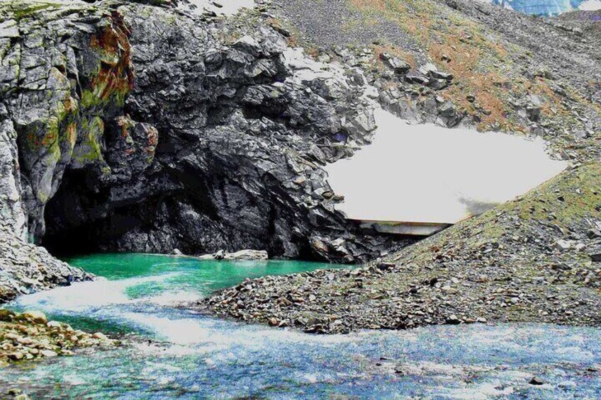
Take a scenic drive from Osh, you will enjoy an exotic natural landscapes, including majestic mountains, diverse flora and glimpses of unusually shaped red rocks. On the way, you will pass by the Papan Reservoir, a vital source of water for the people of Osh and essential for irrigating agricultural lands in Kyrgyzstan and Uzbekistan. The road, although not paved, is in reasonable condition and runs with green mountains covered with juniper lining both sides. Once you reach Kojo-Kelen, you will enjoy lunch at a local guesthouse. then, set off on a 2-3-hour acclimatisation hike to explore the Blue Grotto and a nearby waterfall. Connection: there is electricity, signal (megacom) and Wi-Fi Driving distance: 95km, 3hours (excluding stop on the way) Ascent/Descent: 2260/1050 metres Highest and lowest points: 2230 /980 metres Accommodation altitude: 2230 metres
Day 2: From Kozho-Kelen to Koshmoinok village
  • 1 stop
  • Meals: breakfast, lunch, snacks
  • Accommodation: yurt stay (shared nights on traditional floor, matrass,blankets are available) there are solar shower and flush toilet.
Kichik-Alay
  • 6h
We will begin the second day of the tour on the slopes of the beautiful Cretaceous mountains of Kichik-Alai. First, we cross the Sary-Bel pass (3150m). Then come to camp in Kosh-Moinok Kosh-Moinok is another scenic area, located in the south-western part of Kyrgyzstan, not far from Sary-Bell. This location is known for its stunning mountain scenery and tranquil environment. The name "Kosh-Moinok" roughly means "double pass through the gorge" reflecting the region's pastoral landscape. Ascent/Descent: 1010/350 metres Highest and lowest points: 3130 /2190 metres Accommodation altitude: 2822.00 Metres | 9258.53 Feet Connection: No electricity, internet and signal Accommodation: yurt stay (shared beds on ground with carpet and blankets) there are solar water heater shower and flash toilet. Host: The name of owner is Nurdoolot and Begali.
Day 3: From Kosh-Moinok to yurt camp before the Sary-Mogol pass
  • 1 stop
  • Meals: breakfast, lunch, snacks
  • Accommodation: yurt stay with shared nights on the traditional floor, there are matrass and blankets and water running toilet.
Kichik-Alay
  • 7h
Start by crossing from itself of Kosh-Moynok (3220m) After a short transition descent to the village of Kyzyl-Chara then (3-4 kilometres) along the road through the small village of Sary-Mogol , from here you head to the southern side (left), then the path directed along the mountain river, on both sides of the towering rocks, and subalpine and alpine meadows represent a very diverse landscape. During the hike, at every step you can hear the cries of marmots and birds in these natural areas. As you approach the heights, you feel the marvellous embrace of the surrounding spruce cliffs of the Kichik-Alai mountains. Trekking distance: 18km, 11 miles Time of hiking: 7hours (excluding driving, break and lunch) Ascent/Descent: 1490/820 metres Highest and lowest points: 3495/2412 metres Accommodation altitude: 3458.00 Metres | 11345.14 Feet Connection: No electricity, internet and signal
Day 4: Crossing the Sary-Mogol pass (4280 m) and arriving in Sary-Mogol town
  • 1 stop
  • Meals: breakfast, lunch, snacks
  • Accommodation: Guesthouse. The rooms has double, twin and single beds with hot showers and water running toilets
Alay Valley
  • 6h
  • Admission ticket included
The distance to cross the pass is not long, but the steep ascent requires patience and effort. From the summit of the Sary-Mogol Pass, the landscape transforms into a magical panorama of rugged beauty. Below, the stunning Besh-Kol Lakes (translated as "Five Lakes") shimmer like jewels in the barren terrain. These four interconnected rocky lakes are linked by streams that weave through the landscape before disappearing into an enchanting underground cave—a fascinating natural phenomenon. Descending from the pass, the trail leads you to a peaceful area where a shepherd's yurt stands. From here, our driver will take to Sary-Mogol. Total distance 31km (Driving distance: 17km (1hour by car) Trekking distance: 14km, 8.70 miles Time of hiking: 6hours (excluding driving, break and lunch) Ascent/Descent: 770/930metres Highest and lowest points: 4270 /3354 metres Accommodation altitude: 2976.00 Metres | 9763.78 Feet Connection: there is electricity, internet (Wi-Fi) and signal
Day 5: Sary-Mogol – Peak Panorama – Tulpar-Kol Lake
  • 1 stop
  • Meals: breakfast, lunch, snacks
  • Accommodation: yurt camp (twin, double and single beds are available) solar water heater shower, water running western toilets
Lake Tulpar-Kol
  • 6h
  • Admission ticket included
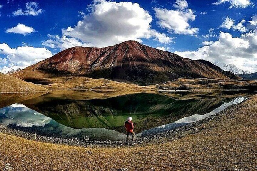
After breakfast, our driver will take you to the beginning of Tuyuk gorge. Once you arrive, begin your trek to see the nice canyon and this trail not only offers solitude and pristine landscapes but also provides some of the best views of Peak Estonia (6,202 m) and Peak Latvia (6,134 m), two impressive peaks in the Zaalaysky Range. After the short hiking from the canyon, your next step will be continued by the guide towards the panoramic view of Tulpar-Kol lakes. Pik Panorama is a stunning viewpoint of Lenin Peak, the Alay Valley and collectively known as the "40 Lakes." Reaching this point is a challenging yet rewarding hike. Elevation: Approximately 4,000 metres After soaking in the stunning scenery, descent to the yurt camp. Easy and short option is available: If you're tired from previous hikes, you can simply walk along the lakeside with below path to Tulpar-Kol
Day 6: Walk to advanced camp
  • 1 stop
  • Meals: breakfast, lunch, snacks
  • Accommodation: Tent on the wooden floor with matrass
Lenin Peak
  • 7h
  • Admission ticket included
The trek to Advanced Camp is an unforgettable journey that takes you past the Base Camp of Lenin Peak and the breathtaking Traveler's Pass, standing at an altitude of 4120m. After approximately 6-7 hours of trekking, you will arrive at Advanced Camp, also known as Camp 1, situated at 4400m above sea level. This camp is located in a cold, snowy environment, with snow permanently covering the Peaks. From here, the views are truly incredible—you'll have a sweeping panorama of the majestic Lenin Peak. Standing so close to this iconic peak is a humbling and awe-inspiring experience. Total distance: 19km 11.80 miles Hiking time: 7hours (excluding lunch and break time) Ascent/Descent: 810/1700 metres Highest and lowest points: 5100/3500 metres Accommodation altitude and type: Tent on the wooden floor with matrass (Need to take your sleeping bag) and altitude is 4400.00 Metres | 14435.70 Feet Connection: there is no signal But Wi-Fi in 5G (star link) is available
Day 7: Climb to Peak Yukhin comeback to Tulpar-Kol or return to Sary-Mogol
  • 2 stops
  • Meals: breakfast, lunch, snacks
  • Accommodation: Same yurt camp
Yukhin Peak
  • 6h
  • Admission ticket included
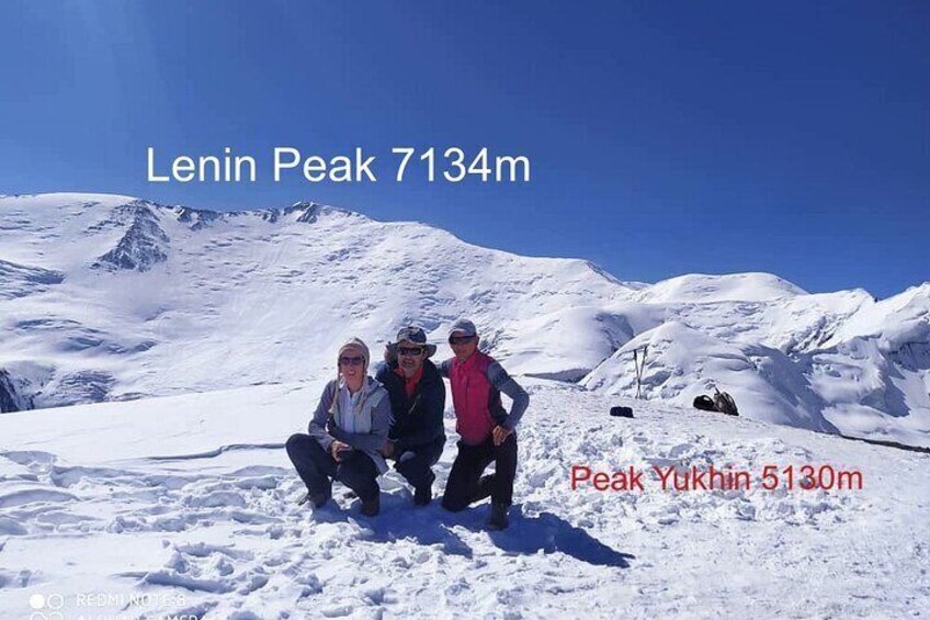
After breakfast, begin your ascent to Peak Yukhin, standing at an impressive altitude of 5130m. This is one of the ideal acclimatisation peaks, allowing climbers to reach the summit without equipment (usual form) However, the climb demands significant physical effort and determination to reach the top. Upon successfully reaching the summit, take a moment to enjoy the breathtaking views and capture unforgettable photos. After a brief rest at the peak, descend back to Tulpar-Kol and stay in same yurt camp for more relaxing and resting. Our tour will be concluded. Total distance: 19km 11.80 miles Hiking time: 6 hours (excluding lunch and break time) Ascent/Descent: 160/1700 metres Highest and lowest points: 5100/3500 metres we offer several options for your next trip
Central Asia
  • 1h
4x4 Transport to the Pamir Highway • Highlights: Embark on a thrilling drive along the legendary Pamir Highway (M41) Marvel at dramatic mountain landscapes, deep valleys, and unique cultural encounters along the Wakhan corridor to Dushanbe Drive to Dostuk Border in Osh (Uzbekistan Connection) • Highlights: Take a scenic drive from Tulpar-Kol to Osh, then head to the Dostuk border crossing. Cross into Uzbekistan to explore Andijan, Tashkent, and other destinations. A convenient option for those continuing their Central Asian journey Visit China via the Erkeshtam Border • Highlights: Travel 120 km from Tulpar-Kol to the Erkeshtam border, a gateway to China. Ideal for travellers wishing to explore the ancient Silk Road cities of Kashgar and onward.

Location

Activity location

  • LOB_ACTIVITIESLOB_ACTIVITIESCar park "Kojo-Kelen"
    • Kyzyl-Tala, Osh Region, Kyrgyzstan

Meeting/Redemption Point

  • PEOPLEPEOPLEOsh City
    • Osh City, Osh City, Kyrgyzstan

Best Deals on Things to Do

Experience the wonders of the world up close with great deals on things to do near and far. Expedia offers one-of-a-kind activities that allow you to explore Kyzyl-Tala your way. Whether you love nature, culture, food or a bit of adventure, we have the perfect activity for you.

Top experiences in Kyzyl-Tala

With so many activities in Kyzyl-Tala, planning the perfect day out may seem like a daunting task. Expedia is here to take the hassle out of finding the best attractions, tours and activities in Kyzyl-Tala. Families, couples and business travellers can all find the perfect activity in Kyzyl-Tala to create life-long memories with the help of Expedia.